by Xavier Bailleau | Jan 9, 2018 | Model & Remote Sensing
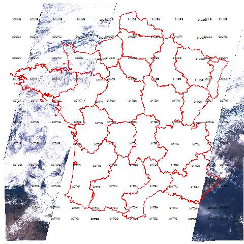
The satellite images user is mainly interested about cloud cover because it is one the major problem to deal with. I wrote a very small and simple program to analyse all the images from Sentinel 2A over France during 2016. It took around 15 hours to check all the...
by Xavier Bailleau | Jan 5, 2018 | Model & Remote Sensing
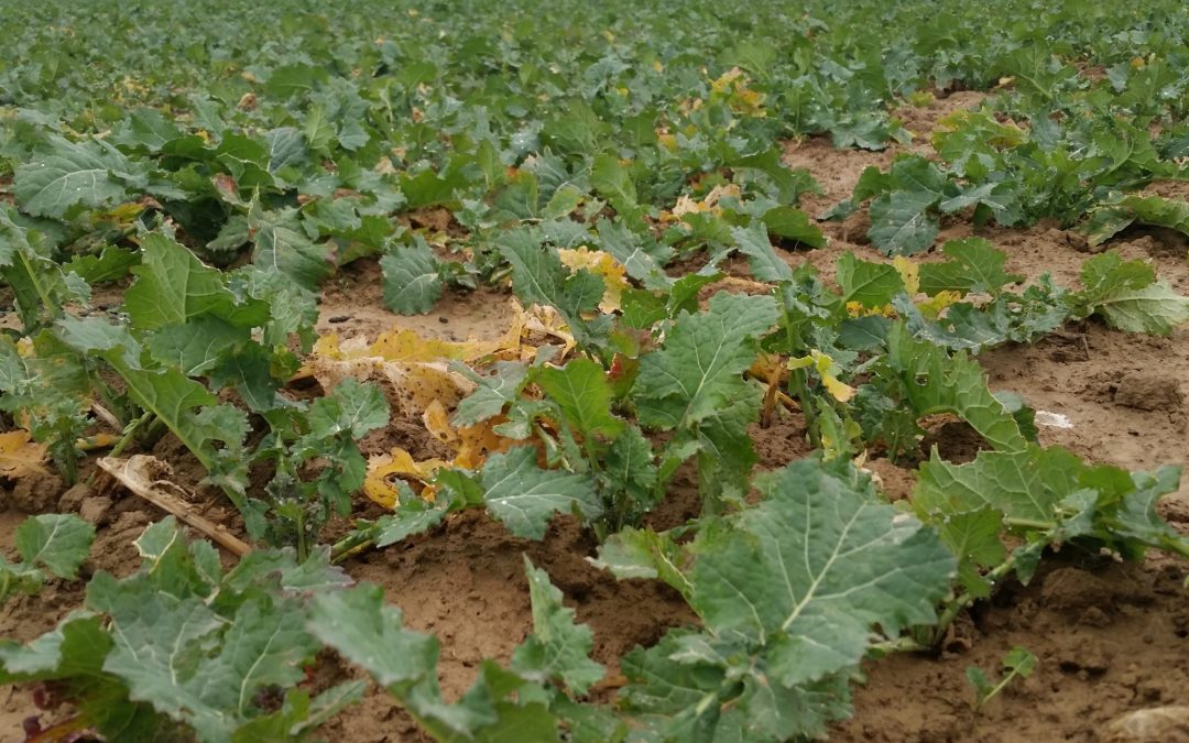
Most of the time, vegetation intra field variability is due to soil heterogeneity, in some cases, it can be due to different agricultural practices or tillage time. This is the case in that rapeseed field, sown on two different dates, as explained in a previous post....
by Xavier Bailleau | Jan 4, 2018 | Model & Remote Sensing, Non classé
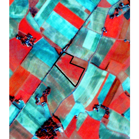
Satfarming provide color composite images to highlight specific crop components. The simplest way to proceed is to replace usual Red, Green and blue components by another wavelength bands combination. Above image grid: Examples of different combination bands as RGB...
by Xavier Bailleau | Dec 14, 2017 | Model & Remote Sensing
Material: Sentinel 2A satellite preview images Methods: Select previews on area of interest and for the acquisition plan date,donwload previews, mosaic raster and cloud check Objective: Check about cloud screen on ground places to make experiments and compare with...
by Xavier Bailleau | Dec 9, 2017 | In The Field
SATFARMING PRODUCT: SPATIAL FIELD CROP ANALYSIS MATERIAL: Satellite images Sentinel 2 (ESA), vegetation index: NDVI METHODOLOGY: Statistical analysis: Average, standard deviation, frequential analysis, raster clustering OBJECTIVE: Highlight areas of interest in a...