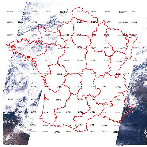
- Material: Sentinel 2A satellite preview images
- Methods: Select previews on area of interest and for the acquisition plan date,donwload previews, mosaic raster and cloud check
- Objective: Check about cloud screen on ground places to make experiments and compare with Sentinel images processing.
The software developped to yield this image is very simple:
- Forecast of acquisition plant from ESA or with a satellite software Prévisat
- For the selected date, download all available previews for the area of interest: AWS
- Rasters are mosaiced and plot on a geographical background